See Details on eBay available at Amazon

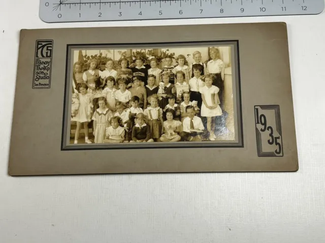
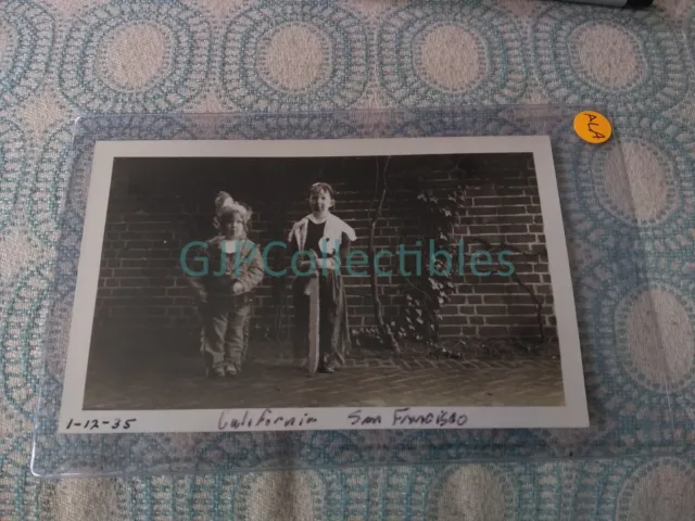
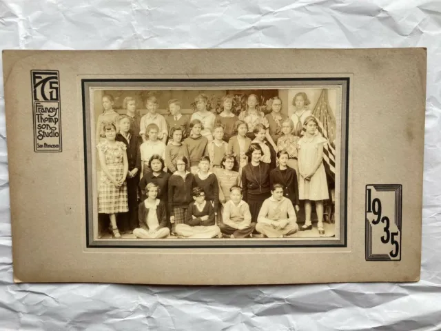
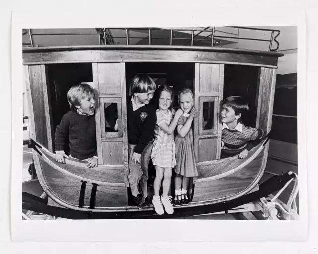
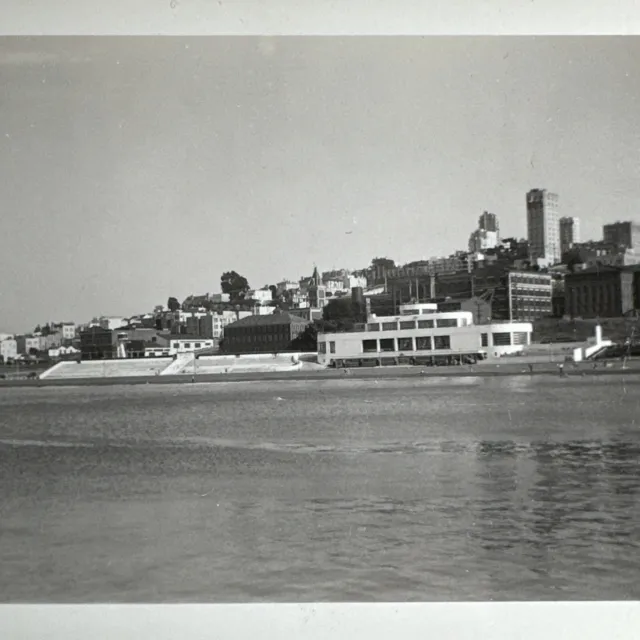
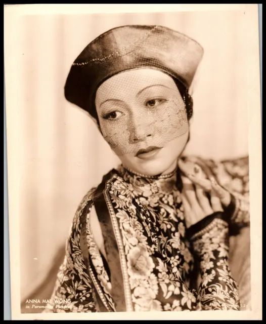
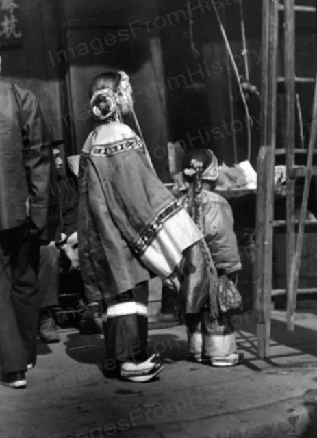
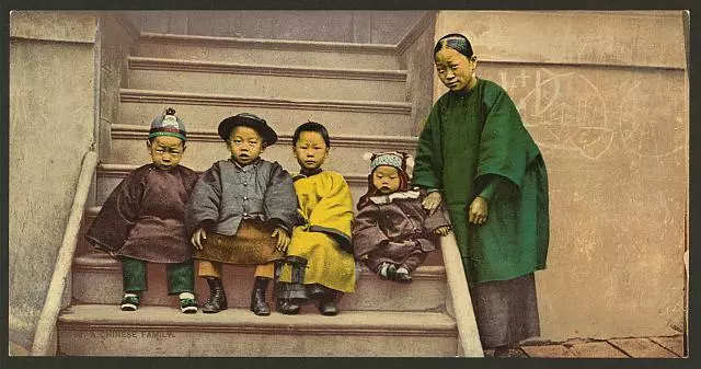
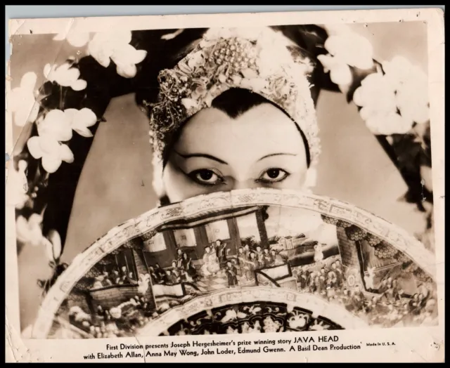
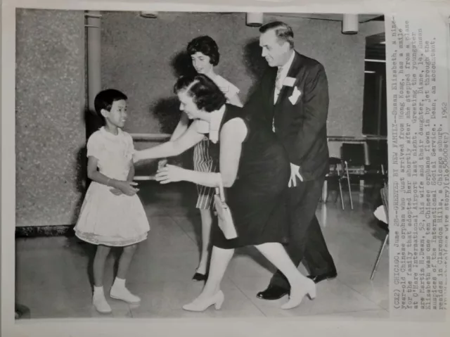
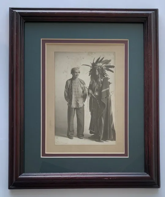
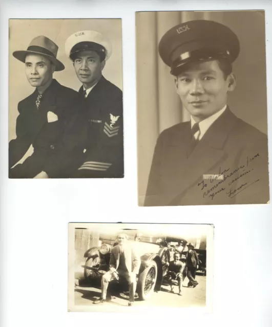
Chinese American Photo 1935 San Francisco Ca Original Children Vintage

$313.21 Buy It Now, FREE Shipping, 30-Day Returns, eBay Money Back Guarantee
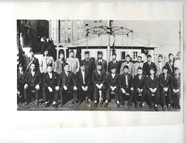
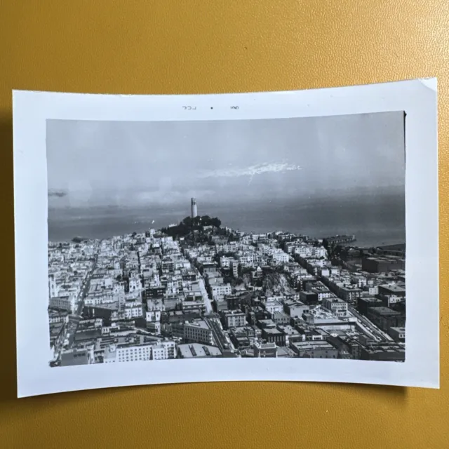
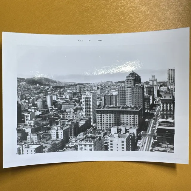
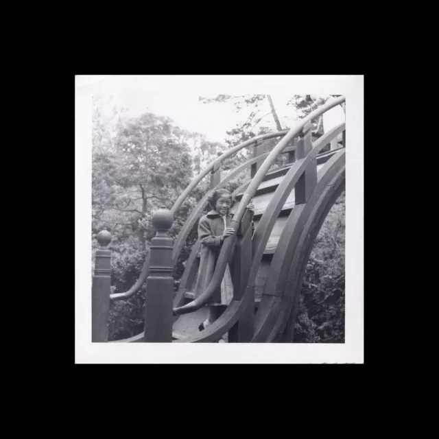
Seller: memorabilia111 ✉️ (812) 97.3%, Location: Ann Arbor, Michigan, US, Ships to: US & many other countries, Item: 176354496730 CHINESE AMERICAN PHOTO 1935 SAN FRANCISCO CA ORIGINAL CHILDREN VINTAGE. A FANTASTIC 6 1/2 X 8 1/2 INCH PHOTOGRAPH OF 123944… -WATCH YOUR CREDIT International NEWS PHOTOS SAN FRANCISCO BUREAU SLUG (ENVOYS OF COURTESY) SAN FRANCISCO , CALIFORNIA FIVE PRETTY CHINESE GIRLS UPHELD THEIR COUNTRIES REPUTATION FOR COURTESY YES- TERDAY THEY CALLED FATHER CUMMINGS, LOCAL SUPERIOR OF THE MARYKNOLL ORDER, TO THANK HIM FOR THE WORK THAT WILL BE DONE IN CHINA BY XXX SIXTEEN YOUNGPRIESTS OF THE ORDER WHO SAILED FROM SAN FRANCISCO A FEW DAYS AGO IN THE GROUP ARE:MISSES IDA NOO, MILDRED LEE, LEATRICE LAMB, MAY DAIR AND IDA CHANG AL BUREAUS-LTST --C-0-60 RE|GN(X)9-|2-35 Father William T. Cummings was born on October 30, 1903 in San Francisco. Because there was no Catholic school in the area he was enrolled at the Freemont Grammar School. For religious instruction he attended Sunday School under the direction of the Holy Family Sisters, and upon graduation at the age of thirteen he had a desire to become a priest. He attended St. Patrick’s Seminary at Menlo Park in 1917 and was there for the next ten years. In September of 19l8 Father Cummings was present at a talk given by Father Price who was then on his way to China. To that inspiring conference he attributed the beginning of his missionary calling. He wanted to come to Maryknoll at the beginning of his second year of Philosophy. This first attempt met with parental objections. The next year he could not go because he was unable to get the permission of his Ordinary who was in Rome. When he was ready for his third attempt his mother became very ill and so he finished another year, his second of Theology, at St. Patrick’s. At last, in August of 1926, he started for Maryknoll. After his last two years of Theology and ordination (June 16, 1928) he was assigned to Los Altos. He taught during the year 1928-29 and was Spiritual Director during 1929-30. Then he was assigned to promotion in San Francisco, assisting Father Keller. He did promotion work for the next ten years. Despite his physical ailments, he had a great desire to go to the missions. In April of 1940 he was assigned to Manila but his back once again caused him trouble. Nevertheless, he begged his superiors not to let the operation be a cause for a change of assignment. In Manila he taught for a while at the Maryknoll Sisters’ school. Then came the war with Japan. He became a chaplain, and during the years of captivity he gave himself to the men and the work. In his book “Give Us This Day” Sidney Steward paints a moving picture of the sufferings the Americans underwent during the Second World War after the fall of Bataan. He describes the dreadful details of their ordeal in the prison camps and in the hold of the prison ship. Father Cummings’ heroism and charity will ever remain a tribute to him. After several years of suffering which he shared with his men, he himself succumbed on January 18, 1945. His death is summed up in the following words: “he died as he would have wanted to die, praying to the God he believed in, to the God that gave him strength.” His remains were consigned to the sea some place en route between the Philippines and Japan. 'Father William T. Cummings was born on October 30, 1903 in San Francisco. Because there was no Catholic school in the area he was enrolled at the Freemont Grammar School. For religious instruction he attended Sunday School under the direction of the Holy Family Sisters, and upon graduation at the age of thirteen he had a desire to become a priest. He attended St. Patrick’s Seminary at Menlo Park in 1917 and was there for the next ten years. In September of 19l8 Father Cummings was present at a talk given by Father Price who was then on his way to China. To that inspiring conference he attributed the beginning of his missionary calling. He wanted to come to Maryknoll at the beginning of his second year of Philosophy. This first attempt met with parental objections. The next year he could not go because he was unable to get the permission of his Ordinary who was in Rome. When he was ready for his third attempt his mother became very ill and so he finished another year, his second of Theology, at St. Patrick’s. At last, in August of 1926, he started for Maryknoll. After his last two years of Theology and ordination (June 16, 1928) he was assigned to Los Altos. He taught during the year 1928-29 and was Spiritual Director during 1929-30. Then he was assigned to promotion in San Francisco, assisting Father Keller. He did promotion work for the next ten years. Despite his physical ailments, he had a great desire to go to the missions. In April of 1940 he was assigned to Manila but his back once again caused him trouble. Nevertheless, he begged his superiors not to let the operation be a cause for a change of assignment. In Manila he taught for a while at the Maryknoll Sisters’ school. Then came the war with Japan. He became a chaplain, and during the years of captivity he gave himself to the men and the work. In his book “Give Us This Day” Sidney Steward paints a moving picture of the sufferings the Americans underwent during the Second World War after the fall of Bataan. He describes the dreadful details of their ordeal in the prison camps and in the hold of the prison ship. Father Cummings’ heroism and charity will ever remain a tribute to him. After several years of suffering which he shared with his men, he himself succumbed on January 18, 1945. His death is summed up in the following words: “he died as he would have wanted to die, praying to the God he believed in, to the God that gave him strength.” His remains were consigned to the sea some place en route between the Philippines and Japan. San Francisco (/ˌsæn frənˈsɪskoʊ/ SAN frən-SISS-koh; Spanish for 'Saint Francis'), officially the City and County of San Francisco, is the commercial, financial, and cultural center of Northern California. The city proper is the fourth most populous city in California, with 808,437 residents, and the 17th most populous city in the United States as of 2022.[16] The city covers a land area of 46.9 square miles (121 square kilometers)[24] at the end of the San Francisco Peninsula, making it the second most densely populated large U.S. city after New York City and the fifth-most densely populated U.S. county, behind only four of the five New York City boroughs. Among the 91 U.S. cities proper with over 250,000 residents, San Francisco was ranked first by per capita income[25] and sixth by aggregate income as of 2021.[26] Colloquial nicknames for San Francisco include Frisco, San Fran, The City, and SF.[27][28] San Francisco was founded on June 29, 1776, when settlers from New Spain established the Presidio of San Francisco at the Golden Gate, and the Mission San Francisco de Asís a few miles away, both named for Francis of Assisi.[4] The California Gold Rush of 1849 brought rapid growth, transforming an unimportant hamlet into a busy port, making it the largest city on the West Coast at the time; between 1870 and 1900, approximately one quarter of California's population resided in the city proper.[26] In 1856, San Francisco became a consolidated city-county.[29] After three-quarters of the city was destroyed by the 1906 earthquake and fire,[30] it was quickly rebuilt, hosting the Panama-Pacific International Exposition nine years later. In World War II, it was a major port of embarkation for naval service members shipping out to the Pacific Theater.[31] In 1945, the United Nations Charter was signed in San Francisco, establishing the United Nations before permanently relocating to Manhattan, and in 1951, the Treaty of San Francisco re-established peaceful relations between Japan and the Allied Powers.[32][33][34] After the war, the confluence of returning servicemen, significant immigration, liberalizing attitudes, the rise of the beatnik and hippie countercultures, the sexual revolution, the peace movement growing from opposition to United States involvement in the Vietnam War, and other factors led to the Summer of Love and the gay rights movement, cementing San Francisco as a center of liberal activism in the United States. San Francisco and the surrounding San Francisco Bay Area are a global center of economic activity and the arts and sciences,[35][36] spurred by leading universities,[37] high-tech, healthcare, finance, insurance, real estate, and professional services sectors.[38] As of 2020, the metropolitan area, with 6.7 million residents, ranked 5th by GDP ($874 billion) and 2nd by GDP per capita ($131,082) across the OECD countries, ahead of global cities like Paris, London, and Singapore.[39][40][41] San Francisco anchors the 13th most populous metropolitan statistical area in the United States with 4.6 million residents, and the fourth-largest by aggregate income and economic output, with a GDP of $669 billion in 2021.[42] The wider San Jose–San Francisco–Oakland Combined Statistical Area is the fifth most populous, with 9.5 million residents, and the third-largest by economic output, with a GDP of $1.25 trillion in 2021. In the same year, San Francisco proper had a GDP of $236.4 billion, and a GDP per capita of $289,990.[42] San Francisco was ranked fifth in the world and second in the United States on the Global Financial Centres Index as of March 2023.[43] The city centers of both San Francisco and nearby Oakland have suffered a severe and continuing exodus of businesses, significantly accelerated by the COVID-19 pandemic.[44] Despite this commercial and corporate exodus, the Bay Area is still the home to four of the world's ten largest companies by market capitalization, and the city proper still houses the headquarters of numerous companies inside and outside of technology, including Wells Fargo, Salesforce, Uber, Airbnb, Twitter, Levi's, Gap, Dropbox, and Lyft.[45][46][47] However, the conservative Hoover Institution in California, in addition to various media organizations, have warned of a uniquely severe long-term doom spiral impending for San Francisco.[48] Theories advanced range from narcotics and other illicit substances, crime, and homelessness,[49] to the West Coast's and particularly San Francisco's challenge to remain a relevant center for flagship commerce and industry given its relative geographic isolation from other North American commercial centers in an era of increasingly ubiquitous e-commerce.[50][51] With over 3.3 million visitors as of 2019, San Francisco is the fifth-most visited city in the United States after New York City, Miami, Los Angeles, and Orlando.[52] The city is known for its steep rolling hills and eclectic mix of architecture across varied neighborhoods, as well as its cool summers, fog, and landmarks, including the Golden Gate Bridge, cable cars, Alcatraz, along with the Chinatown and Mission districts.[53] The city is home to a number of educational and cultural institutions, such as the University of California, San Francisco, the University of San Francisco, San Francisco State University, the San Francisco Conservatory of Music, the de Young Museum, the San Francisco Museum of Modern Art, the San Francisco Symphony, the San Francisco Ballet, the San Francisco Opera, the SFJAZZ Center, and the California Academy of Sciences. Two major league sports teams, the San Francisco Giants and the Golden State Warriors, play their home games within San Francisco proper. San Francisco's main international airport offers flights to over 125 destinations while a light rail and bus network, in tandem with the BART and Caltrain systems, connects nearly every part of San Francisco with the wider region.[54][55] Etymology See also: List of San Francisco placename etymologies The city takes its name from Mission San Francisco de Asís, founded in 1776 in honor of Saint Francis. San Francisco, which is Spanish for "Saint Francis", takes its name from Mission San Francisco de Asís, which was named after Saint Francis of Assisi. The mission received its name in 1776, when it was founded by the Spanish under the leadership of Padre Francisco Palóu. The city has officially been known as San Francisco since 1847, when Washington Allon Bartlett, then serving as the city's alcalde, renamed it from Yerba Buena (Spanish for "Good Herb"), which had been name used throughout the Spanish and Mexican eras since approximately 1776. The name Yerba Buena continues to be used in locations in the city, such as Yerba Buena Island, the Yerba Buena Center for the Arts, and Yerba Buena Gardens. Bay Area residents often refer to San Francisco as "the City".[1] For residents of San Francisco living in the more suburban parts of the city, "the City" generally refers to the densely populated areas around Market Street. Its use, or lack thereof, is a common way for locals to distinguish long time residents from tourists and recent arrivals (as a shibboleth). San Francisco has several nicknames, including "The City by the Bay", "Golden Gate City",[56] "Frisco", "SF", "San Fran", and "Fog City"; as well as older ones like "The City that Knows How", "Baghdad by the Bay", or "The Paris of the West".[1] "San Fran" and "Frisco" are controversial as nicknames among San Francisco residents.[57][58][59] History See also: History of San Francisco For a chronological guide, see Timeline of San Francisco. Indigenous history The earliest archeological evidence of human habitation of the territory of the city of San Francisco dates to 3000 BC.[60] The Yelamu group of the Ohlone people resided in a few small villages when an overland Spanish exploration party arrived on November 2, 1769, the first documented European visit to San Francisco Bay.[61] The Ohlone name for San Francisco was Ahwaste, meaning, "place at the bay".[62] Spanish era Juan Bautista de Anza established the Presidio of San Francisco for the Spanish Empire in 1776. Mission San Francisco de Asís was founded by Padre Francisco Palóu on October 9, 1776. The Spanish Empire claimed San Francisco as part of Las Californias, a province of the Viceroyalty of New Spain. The Spanish first arrived in what is now San Francisco on November 2, 1769, when the Portolá expedition led by Don Gaspar de Portolá and Juan Crespí arrived at San Francisco Bay. Having noted the strategic benefits of the area due to its large natural harbor, the Spanish dispatched Pedro Fages in 1770 to find a more direct route to the San Francisco Peninsula from Monterey, which would become part of the El Camino Real route. By 1774, Juan Bautista de Anza had arrived to the area to select the sites for a mission and presidio. The first European maritime presence in San Francisco Bay occurred on August 5, 1775, when the Spanish ship San Carlos, commanded by Juan Manuel de Ayala, became the first ship to anchor in the bay.[63] Soon after, on March 28, 1776, Anza established the Presidio of San Francisco. On October 9, Mission San Francisco de Asís, also known as Mission Dolores, was founded by Padre Francisco Palóu.[4] In 1794, the Presidio established the Castillo de San Joaquín, a fortification on the southern side of the Golden Gate, which later came to be known as Fort Point. In 1804, the province of Alta California was created, which included San Francisco. At its peak in 1810–1820, the average population at the Mission Dolores settlement was about 1,100 people.[64] Mexican era Juana Briones de Miranda, known as the "Founding Mother of San Francisco"[65] In 1821, the Californias were ceded to Mexico by Spain. The extensive California mission system gradually lost its influence during the period of Mexican rule. Agricultural land became largely privatized as ranchos, as was occurring in other parts of California. Coastal trade increased, including a half-dozen barques from various Atlantic ports which regularly sailed in California waters.[66][67] Yerba Buena (after a native herb), a trading post with settlements between the Presidio and Mission grew up around the Plaza de Yerba Buena. The plaza was later renamed Portsmouth Square (now located in the city's Chinatown and Financial District). The Presidio was commanded in 1833 by Captain Mariano G. Vallejo.[66] In 1833, Juana Briones de Miranda built her rancho near El Polín Spring, founding the first civilian household in San Francisco, which had previously only been comprised by the military settlement at the Presidio and the religious settlement at Mission Dolores.[65] In 1834, Francisco de Haro became the first Alcalde of Yerba Buena. De Haro was a native of Mexico, from that nation's west coast city of Compostela, Nayarit. A land survey of Yerba Buena was made by the Swiss immigrant Jean Jacques Vioget as prelude to the city plan. The second Alcalde José Joaquín Estudillo was a Californio from a prominent Monterey family. In 1835, while in office, he approved the first land grant in Yerba Buena: to William Richardson, a naturalized Mexican citizen of English birth. Richardson had arrived in San Francisco aboard a whaling ship in 1822. In 1825, he married Maria Antonia Martinez, eldest daughter of the Californio Ygnacio Martínez.[68][a] The 1846 Battle of Yerba Buena was an early U.S. victory in the American conquest of California. Yerba Buena began to attract American and European settlers; an 1842 census listed 21 residents (11%) born in the United States or Europe, as well as one Filipino merchant.[69] Following the Bear Flag Revolt in Sonoma and the beginning of the U.S. Conquest of California, American forces under the command of John B. Montgomery captured Yerba Buena on July 9, 1846, with little resistance from the local Californio population. Following the capture, U.S. forces appointed both José de Jesús Noé and Washington Allon Bartlett to serve as co-alcaldes (mayors), while the conquest continued on in the rest of California. Following the Treaty of Guadalupe Hidalgo in 1848, Alta California was ceded from Mexico to the United States. Post-Conquest era San Francisco in 1849, during the beginning of the California Gold Rush Port of San Francisco in 1851 Despite its attractive location as a port and naval base, post-Conquest San Francisco was still a small settlement with inhospitable geography.[70] Its 1847 population was said to be 459.[66] The California Gold Rush brought a flood of treasure seekers (known as "forty-niners", as in "1849"). With their sourdough bread in tow,[71] prospectors accumulated in San Francisco over rival Benicia,[72] raising the population from 1,000 in 1848 to 25,000 by December 1849.[73] The promise of wealth was so strong that crews on arriving vessels deserted and rushed off to the gold fields, leaving behind a forest of masts in San Francisco harbor.[74] Some of these approximately 500 abandoned ships were used at times as storeships, saloons, and hotels; many were left to rot, and some were sunk to establish title to the underwater lot. By 1851, the harbor was extended out into the bay by wharves while buildings were erected on piles among the ships. By 1870, Yerba Buena Cove had been filled to create new land. Buried ships are occasionally exposed when foundations are dug for new buildings.[75] California was quickly granted statehood in 1850, and the U.S. military built Fort Point at the Golden Gate and a fort on Alcatraz Island to secure the San Francisco Bay. San Francisco County was one of the state's 18 original counties established at California statehood in 1850.[76] Until 1856, San Francisco's city limits extended west to Divisadero Street and Castro Street, and south to 20th Street. In 1856, the California state government divided the county. A straight line was then drawn across the tip of the San Francisco Peninsula just north of San Bruno Mountain. Everything south of the line became the new San Mateo County while everything north of the line became the new consolidated City and County of San Francisco.[77] The Bank of California, established in 1863, was the first commercial bank in Western United States.[78] Entrepreneurs sought to capitalize on the wealth generated by the Gold Rush. Silver discoveries, including the Comstock Lode in Nevada in 1859, further drove rapid population growth.[79] With hordes of fortune seekers streaming through the city, lawlessness was common, and the Barbary Coast section of town gained notoriety as a haven for criminals, prostitution, bootlegging, and gambling.[80] Early winners were the banking industry, with the founding of Wells Fargo in 1852 and the Bank of California in 1864. Development of the Port of San Francisco and the establishment in 1869 of overland access to the eastern U.S. rail system via the newly completed Pacific Railroad (the construction of which the city only reluctantly helped support[81]) helped make the Bay Area a center for trade. Catering to the needs and tastes of the growing population, Levi Strauss opened a dry goods business and Domingo Ghirardelli began manufacturing chocolate. Chinese immigrants made the city a polyglot culture, drawn to "Old Gold Mountain", creating the city's Chinatown quarter. By 1880, Chinese made up 9.3% of the population.[82] View of the city in 1878 The first cable cars carried San Franciscans up Clay Street in 1873. The city's sea of Victorian houses began to take shape, and civic leaders campaigned for a spacious public park, resulting in plans for Golden Gate Park. San Franciscans built schools, churches, theaters, and all the hallmarks of civic life. The Presidio developed into the most important American military installation on the Pacific coast.[83] By 1890, San Francisco's population approached 300,000, making it the eighth-largest city in the United States at the time. Around 1901, San Francisco was a major city known for its flamboyant style, stately hotels, ostentatious mansions on Nob Hill, and a thriving arts scene.[84] The first North American plague epidemic was the San Francisco plague of 1900–1904.[85] 1906 earthquake and interwar era The 1906 San Francisco earthquake was the deadliest earthquake in U.S. history. At 5:12 am on April 18, 1906, a major earthquake struck San Francisco and northern California. As buildings collapsed from the shaking, ruptured gas lines ignited fires that spread across the city and burned out of control for several days. With water mains out of service, the Presidio Artillery Corps attempted to contain the inferno by dynamiting blocks of buildings to create firebreaks.[86] More than three-quarters of the city lay in ruins, including almost all of the downtown core.[30] Contemporary accounts reported that 498 people died, though modern estimates put the number in the several thousands.[87] More than half of the city's population of 400,000 was left homeless.[88] Refugees settled temporarily in makeshift tent villages in Golden Gate Park, the Presidio, on the beaches, and elsewhere. Many fled permanently to the East Bay. Jack London is remembered for having famously eulogized the earthquake: "Not in history has a modern imperial city been so completely destroyed. San Francisco is gone."[89] The reconstruction of San Francisco City Hall on Civic Center Plaza, c. 1913–16 Rebuilding was rapid and performed on a grand scale. Rejecting calls to completely remake the street grid, San Franciscans opted for speed.[90] Amadeo Giannini's Bank of Italy, later to become Bank of America, provided loans for many of those whose livelihoods had been devastated. The influential San Francisco Planning and Urban Research Association or SPUR was founded in 1910 to address the quality of housing after the earthquake.[91] The earthquake hastened development of western neighborhoods that survived the fire, including Pacific Heights, where many of the city's wealthy rebuilt their homes.[92] In turn, the destroyed mansions of Nob Hill became grand hotels. City Hall rose again in the Beaux Arts style, and the city celebrated its rebirth at the Panama–Pacific International Exposition in 1915.[93] The Panama–Pacific Exposition, a major world's fair held in 1915, was seen as a chance to showcase the city's recovery from the earthquake. During this period, San Francisco built some of its most important infrastructure. Civil Engineer Michael O'Shaughnessy was hired by San Francisco Mayor James Rolph as chief engineer for the city in September 1912 to supervise the construction of the Twin Peaks Reservoir, the Stockton Street Tunnel, the Twin Peaks Tunnel, the San Francisco Municipal Railway, the Auxiliary Water Supply System, and new sewers. San Francisco's streetcar system, of which the J, K, L, M, and N lines survive today, was pushed to completion by O'Shaughnessy between 1915 and 1927. It was the O'Shaughnessy Dam, Hetch Hetchy Reservoir, and Hetch Hetchy Aqueduct that would have the largest effect on San Francisco.[94] An abundant water supply enabled San Francisco to develop into the city it has become today. The Bay Bridge under construction on Yerba Buena Island in 1935 In ensuing years, the city solidified its standing as a financial capital; in the wake of the 1929 stock market crash, not a single San Francisco-based bank failed.[95] Indeed, it was at the height of the Great Depression that San Francisco undertook two great civil engineering projects, simultaneously constructing the San Francisco–Oakland Bay Bridge and the Golden Gate Bridge, completing them in 1936 and 1937, respectively. It was in this period that the island of Alcatraz, a former military stockade, began its service as a federal maximum security prison, housing notorious inmates such as Al Capone, and Robert Franklin Stroud, the Birdman of Alcatraz. San Francisco later celebrated its regained grandeur with a World's fair, the Golden Gate International Exposition in 1939–40, creating Treasure Island in the middle of the bay to house it.[96] Contemporary era See also: San Francisco in the 1970s The United Nations was created in San Francisco in 1945, when the United Nations Charter was signed at the San Francisco Conference. During World War II, the city-owned Sharp Park in Pacifica was used as an internment camp to detain Japanese Americans.[97] Hunters Point Naval Shipyard became a hub of activity, and Fort Mason became the primary port of embarkation for service members shipping out to the Pacific Theater of Operations.[31] The explosion of jobs drew many people, especially African Americans from the South, to the area. After the end of the war, many military personnel returning from service abroad and civilians who had originally come to work decided to stay. The United Nations Charter creating the United Nations was drafted and signed in San Francisco in 1945 and, in 1951, the Treaty of San Francisco re-established peaceful relations between Japan and the Allied Powers.[98] Urban planning projects in the 1950s and 1960s involved widespread destruction and redevelopment of west-side neighborhoods and the construction of new freeways, of which only a series of short segments were built before being halted by citizen-led opposition.[99] The onset of containerization made San Francisco's small piers obsolete, and cargo activity moved to the larger Port of Oakland.[100] The city began to lose industrial jobs and turned to tourism as the most important segment of its economy.[101] The suburbs experienced rapid growth, and San Francisco underwent significant demographic change, as large segments of the white population left the city, supplanted by an increasing wave of immigration from Asia and Latin America.[102][103] From 1950 to 1980, the city lost over 10 percent of its population. The Summer of Love in 1967 was an influential counterculture phenomenon with as many as 100,000 people converging in San Francisco's Haight-Ashbury neighborhood. Over this period, San Francisco became a magnet for America's counterculture movement. Beat Generation writers fueled the San Francisco Renaissance and centered on the North Beach neighborhood in the 1950s.[104] Hippies flocked to Haight-Ashbury in the 1960s, reaching a peak with the 1967 Summer of Love.[105] In 1974, the Zebra murders left at least 16 people dead.[106] In the 1970s, the city became a center of the gay rights movement, with the emergence of The Castro as an urban gay village, the election of Harvey Milk to the Board of Supervisors, and his assassination, along with that of Mayor George Moscone, in 1978.[107] Bank of America, now based in Charlotte, North Carolina, was founded in San Francisco; the bank completed 555 California Street in 1969. The Transamerica Pyramid was completed in 1972,[108] igniting a wave of "Manhattanization" that lasted until the late 1980s, a period of extensive high-rise development downtown.[109] The 1980s also saw a dramatic increase in the number of homeless people in the city, an issue that remains today, despite many attempts to address it.[110] Transamerica Pyramid, built in 1972, characterized the Manhattanization of the city's skyline in the 1970–80's. The 1989 Loma Prieta earthquake caused destruction and loss of life throughout the Bay Area. In San Francisco, the quake severely damaged structures in the Marina and South of Market districts and precipitated the demolition of the damaged Embarcadero Freeway and much of the damaged Central Freeway, allowing the city to reclaim The Embarcadero as its historic downtown waterfront and revitalizing the Hayes Valley neighborhood.[111] The two recent decades have seen booms driven by the internet industry. During the dot-com boom of the late 1990s, startup companies invigorated the San Francisco economy. Large numbers of entrepreneurs and computer application developers moved into the city, followed by marketing, design, and sales professionals, changing the social landscape as once poorer neighborhoods became increasingly gentrified.[112] Demand for new housing and office space ignited a second wave of high-rise development, this time in the South of Market district.[113] By 2000, the city's population reached new highs, surpassing the previous record set in 1950. When the bubble burst in 2001 and again in 2023, many of these companies folded and their employees were laid off. Yet high technology and entrepreneurship remain mainstays of the San Francisco economy. By the mid-2000s (decade), the social media boom had begun, with San Francisco becoming a popular location for tech offices and a common place to live for people employed in Silicon Valley companies such as Apple and Google.[114] The Ferry Station Post Office Building, Armour & Co. Building, Atherton House, and YMCA Hotel are historic buildings among dozens of historical landmarks in the city according to the National Register of Historic Places listings in San Francisco.[115] Geography Satellite view of San Francisco San Francisco is located on the West Coast of the United States, at the north end of the San Francisco Peninsula and includes significant stretches of the Pacific Ocean and San Francisco Bay within its boundaries. Several picturesque islands—Alcatraz, Treasure Island and the adjacent Yerba Buena Island, and small portions of Alameda Island, Red Rock Island, and Angel Island—are part of the city. Also included are the uninhabited Farallon Islands, 27 miles (43 km) offshore in the Pacific Ocean. The mainland within the city limits roughly forms a "seven-by-seven-mile square", a common local colloquialism referring to the city's shape, though its total area, including water, is nearly 232 square miles (600 km2). There are more than 50 hills within the city limits.[116] Some neighborhoods are named after the hill on which they are situated, including Nob Hill, Potrero Hill, and Russian Hill. Near the geographic center of the city, southwest of the downtown area, are a series of less densely populated hills. Twin Peaks, a pair of hills forming one of the city's highest points, forms an overlook spot. San Francisco's tallest hill, Mount Davidson, is 928 feet (283 m) high and is capped with a 103-foot (31 m) tall cross built in 1934.[117] Dominating this area is Sutro Tower, a large red and white radio and television transmission tower reaching 1,811 ft (552 m) above sea level. Lake Merced, located in southwestern San Francisco The nearby San Andreas and Hayward Faults are responsible for much earthquake activity, although neither physically passes through the city itself. The San Andreas Fault caused the earthquakes in 1906 and 1989. Minor earthquakes occur on a regular basis. The threat of major earthquakes plays a large role in the city's infrastructure development. The city constructed an auxiliary water supply system and has repeatedly upgraded its building codes, requiring retrofits for older buildings and higher engineering standards for new construction.[118] However, there are still thousands of smaller buildings that remain vulnerable to quake damage.[119] USGS has released the California earthquake forecast which models earthquake occurrence in California.[120] San Francisco's shoreline has grown beyond its natural limits. Entire neighborhoods such as the Marina, Mission Bay, and Hunters Point, as well as large sections of the Embarcadero, sit on areas of landfill. Treasure Island was constructed from material dredged from the bay as well as material resulting from the excavation of the Yerba Buena Tunnel through Yerba Buena Island during the construction of the Bay Bridge. Such land tends to be unstable during earthquakes. The resulting soil liquefaction causes extensive damage to property built upon it, as was evidenced in the Marina district during the 1989 Loma Prieta earthquake.[121] A few natural lakes and creeks (Lake Merced, Mountain Lake, Pine Lake, Lobos Creek, El Polin Spring) are within parks and remain protected in what is essentially their original form, but most of the city's natural watercourses, such as Islais Creek and Mission Creek, have been partially or completely culverted and built over. Since the 1990s, however, the Public Utilities Commission has been studying proposals to daylight or restore some creeks.[122] Neighborhoods Main articles: Neighborhoods in San Francisco and List of Landmarks and Historic Places in San Francisco See also: List of tallest buildings in San Francisco View of the city's central districts along its northwestern coastline The historic center of San Francisco is the northeast quadrant of the city anchored by Market Street and the waterfront. Here the Financial District is centered, with Union Square, the principal shopping and hotel district, and the Tenderloin nearby. Cable cars carry riders up steep inclines to the summit of Nob Hill, once the home of the city's business tycoons, and down to the waterfront tourist attractions of Fisherman's Wharf, and Pier 39, where many restaurants feature Dungeness crab from a still-active fishing industry. Also in this quadrant are Russian Hill, a residential neighborhood with the famously crooked Lombard Street; North Beach, the city's Little Italy and the former center of the Beat Generation; and Telegraph Hill, which features Coit Tower. Abutting Russian Hill and North Beach is San Francisco's Chinatown, the oldest Chinatown in North America.[123][124][125][126] The South of Market, which was once San Francisco's industrial core, has seen significant redevelopment following the construction of Oracle Park and an infusion of startup companies. New skyscrapers, live-work lofts, and condominiums dot the area. Further development is taking place just to the south in Mission Bay area, a former railroad yard, which now has a second campus of the University of California, San Francisco and Chase Center, which opened in 2019 as the new home of the Golden State Warriors.[127] West of downtown, across Van Ness Avenue, lies the large Western Addition neighborhood, which became established with a large African American population after World War II. The Western Addition is usually divided into smaller neighborhoods including Hayes Valley, the Fillmore, and Japantown, which was once the largest Japantown in North America but suffered when its Japanese American residents were forcibly removed and interned during World War II. The Western Addition survived the 1906 earthquake with its Victorians largely intact, including the famous "Painted Ladies", standing alongside Alamo Square. To the south, near the geographic center of the city is Haight-Ashbury, famously associated with 1960s hippie culture.[128] The Haight is now[timeframe?] home to some expensive boutiques[129][better source needed] and a few controversial chain stores,[130] although it still retains[timeframe?][citation needed] some bohemian character. San Francisco Chinatown, the oldest in North America and one of the world's largest. North of the Western Addition is Pacific Heights, an affluent neighborhood that features the homes built by wealthy San Franciscans in the wake of the 1906 earthquake. Directly north of Pacific Heights facing the waterfront is the Marina, a neighborhood popular with young professionals that was largely built on reclaimed land from the Bay.[131] In the southeast quadrant of the city is the Mission District—populated in the 19th century by Californios and working-class immigrants from Germany, Ireland, Italy, and Scandinavia. In the 1910s, a wave of Central American immigrants settled in the Mission and, in the 1950s, immigrants from Mexico began to predominate.[132] In recent years, gentrification has changed the demographics of parts of the Mission from Latino, to twenty-something professionals. Noe Valley to the southwest and Bernal Heights to the south are both increasingly popular among young families with children. East of the Mission is the Potrero Hill neighborhood, a mostly residential neighborhood that features sweeping views of downtown San Francisco. West of the Mission, the area historically known as Eureka Valley, now popularly called the Castro, was once a working-class Scandinavian and Irish area. It has become North America's first gay village, and is now the center of gay life in the city.[133] Located near the city's southern border, the Excelsior District is one of the most ethnically diverse neighborhoods in San Francisco. The Bayview-Hunters Point in the far southeast corner of the city is one of the poorest neighborhoods, though the area has been the focus of several revitalizing and urban renewal projects. The Ferry Building, located in the Embarcadero, the city's eastern waterfront along San Francisco Bay The construction of the Twin Peaks Tunnel in 1918 connected southwest neighborhoods to downtown via streetcar, hastening the development of West Portal, and nearby affluent Forest Hill and St. Francis Wood. Further west, stretching all the way to the Pacific Ocean and north to Golden Gate Park lies the vast Sunset District, a large middle-class area with a predominantly Asian population.[134] The northwestern quadrant of the city contains the Richmond, a mostly middle-class neighborhood north of Golden Gate Park, home to immigrants from other parts of Asia as well as many Russian and Ukrainian immigrants. Together, these areas are known as The Avenues. These two districts are each sometimes further divided into two regions: the Outer Richmond and Outer Sunset can refer to the more western portions of their respective district and the Inner Richmond and Inner Sunset can refer to the more eastern portions. Many piers remained derelict for years until the demolition of the Embarcadero Freeway reopened the downtown waterfront, allowing for redevelopment. The centerpiece of the port, the Ferry Building, while still receiving commuter ferry traffic, has been restored and redeveloped as a gourmet marketplace. Climate San Francisco fog is a regular phenomenon in the summer. San Francisco has a warm-summer Mediterranean climate (Köppen Csb), characteristic of California's coast, with moist, mild winters and dry summers.[135] San Francisco's weather is strongly influenced by the cool currents of the Pacific Ocean on the west side of the city, and the water of San Francisco Bay to the north and east. This moderates temperature swings and produces a remarkably mild year-round climate with little seasonal temperature variation.[136] Among major U.S. cities, San Francisco has the coolest daily mean, maximum, and minimum temperatures for June, July, and August.[137] During the summer, rising hot air in California's interior valleys creates a low-pressure area that draws winds from the North Pacific High through the Golden Gate, which creates the city's characteristic cool winds and fog.[138] The fog is less pronounced in eastern neighborhoods and during the late summer and early fall. As a result, the year's warmest month, on average, is September, and on average, October is warmer than July, especially in daytime. Temperatures reach or exceed 80 °F (27 °C) on an average of only 21 and 23 days a year at downtown and San Francisco International Airport (SFO), respectively.[139] The dry period of May to October is mild to warm, with the normal monthly mean temperature peaking in September at 62.7 °F (17.1 °C).[139] The rainy period of November to April is slightly cooler, with the normal monthly mean temperature reaching its lowest in January at 51.3 °F (10.7 °C).[139] On average, there are 73 rainy days a year, and annual precipitation averages 23.65 inches (601 mm).[139] Variation in precipitation from year to year is high. Above-average rain years are often associated with warm El Niño conditions in the Pacific while dry years often occur in cold water La Niña periods. In 2013 (a "La Niña" year), a record low 5.59 in (142 mm) of rainfall was recorded at downtown San Francisco, where records have been kept since 1849.[139] Snowfall in the city is very rare, with only 10 measurable accumulations recorded since 1852, most recently in 1976 when up to 5 inches (13 cm) fell on Twin Peaks.[140][141] The Farallon Islands are located in the Gulf of the Farallones, off the Pacific coast of San Francisco. The highest recorded temperature at the official National Weather Service downtown observation station[b] was 106 °F (41 °C) on September 1, 2017.[143] During that hot spell, the warmest ever night of 71 °F (22 °C) was also recorded.[144] The lowest recorded temperature was 27 °F (−3 °C) on December 11, 1932.[145] The National Weather Service provides a helpful visual aid[146] graphing the information in the table below to display visually by month the annual typical temperatures, the past year's temperatures, and record temperatures.[importance?] During an average year between 1991 and 2020, San Francisco recorded a warmest night at 64 °F (18 °C) and a coldest day at 49 °F (9 °C).[139] The coldest daytime high since the station's opening in 1945 was recorded in December 1972 at 37 °F (3 °C).[139] As a coastal city, San Francisco will be heavily affected by climate change. As of 2021, sea levels are projected to rise by as much as 5 feet (1.5 m), resulting in periodic flooding, rising groundwater levels, and lowland floods from more severe storms.[147] San Francisco falls under the USDA 10b Plant hardiness zone, though some areas, particularly downtown, border zone 11a.[148][149] vte Climate data for San Francisco (downtown),[c] 1991–2020 normals,[d] extremes 1849–present Month Jan Feb Mar Apr May Jun Jul Aug Sep Oct Nov Dec Year Record high °F (°C) 79 (26) 81 (27) 87 (31) 94 (34) 97 (36) 103 (39) 99 (37) 98 (37) 106 (41) 102 (39) 86 (30) 76 (24) 106 (41) Mean maximum °F (°C) 67.1 (19.5) 71.8 (22.1) 76.4 (24.7) 80.7 (27.1) 81.4 (27.4) 84.6 (29.2) 80.5 (26.9) 83.4 (28.6) 90.8 (32.7) 87.9 (31.1) 75.8 (24.3) 66.4 (19.1) 94.0 (34.4) Average high °F (°C) 57.8 (14.3) 60.4 (15.8) 62.1 (16.7) 63.0 (17.2) 64.1 (17.8) 66.5 (19.2) 66.3 (19.1) 67.9 (19.9) 70.2 (21.2) 69.8 (21.0) 63.7 (17.6) 57.9 (14.4) 64.1 (17.8) Daily mean °F (°C) 52.2 (11.2) 54.2 (12.3) 55.5 (13.1) 56.4 (13.6) 57.8 (14.3) 59.7 (15.4) 60.3 (15.7) 61.7 (16.5) 62.9 (17.2) 62.1 (16.7) 57.2 (14.0) 52.5 (11.4) 57.7 (14.3) Average low °F (°C) 46.6 (8.1) 47.9 (8.8) 48.9 (9.4) 49.7 (9.8) 51.4 (10.8) 53.0 (11.7) 54.4 (12.4) 55.5 (13.1) 55.6 (13.1) 54.4 (12.4) 50.7 (10.4) 47.0 (8.3) 51.3 (10.7) Mean minimum °F (°C) 40.5 (4.7) 42.0 (5.6) 43.7 (6.5) 45.0 (7.2) 48.0 (8.9) 50.1 (10.1) 51.6 (10.9) 52.9 (11.6) 52.0 (11.1) 49.9 (9.9) 44.9 (7.2) 40.7 (4.8) 38.8 (3.8) Record low °F (°C) 29 (−2) 31 (−1) 33 (1) 40 (4) 42 (6) 46 (8) 47 (8) 46 (8) 47 (8) 43 (6) 38 (3) 27 (−3) 27 (−3) Average precipitation inches (mm) 4.40 (112) 4.37 (111) 3.15 (80) 1.60 (41) 0.70 (18) 0.20 (5.1) 0.01 (0.25) 0.06 (1.5) 0.10 (2.5) 0.94 (24) 2.60 (66) 4.76 (121) 22.89 (581) Average precipitation days (≥ 0.01 in) 11.2 10.8 10.8 6.8 4.0 1.6 0.7 1.1 1.2 3.5 7.9 11.6 71.2 Average relative humidity (%) 80 77 75 72 72 71 75 75 73 71 75 78 75 Mean monthly sunshine hours 185.9 207.7 269.1 309.3 325.1 311.4 313.3 287.4 271.4 247.1 173.4 160.6 3,061.7 Percent possible sunshine 61 69 73 78 74 70 70 68 73 71 57 54 69 Average ultraviolet index 2 3 5 7 9 10 10 9 7 5 3 2 6 Source 1: NOAA (sun 1961–1974)[139][150][151][152] Source 2: Met Office (humidity)[153], Weather Atlas (UV)[154] Time Series Graphs are temporarily unavailable due to technical issues. See or edit raw graph data. Ecology Aerial view of the Presidio of San Francisco and the Golden Gate Historically, tule elk were present in San Francisco County, based on archeological evidence of elk remains in at least five different Native American shellmounds: at Hunter's Point, Fort Mason, Stevenson Street, Market Street, and Yerba Buena.[155][156] Perhaps the first historical observer record was from the De Anza Expedition on March 23, 1776. Herbert Eugene Bolton wrote about the expedition camp at Mountain Lake, near the southern end of today's Presidio: "Round about were grazing deer, and scattered here and there were the antlers of large elk."[157] Also, when Richard Henry Dana Jr. visited San Francisco Bay in 1835, he wrote about vast elk herds near the Golden Gate: on December 27 "...we came to anchor near the mouth of the bay, under a high and beautifully sloping hill, upon which herds of hundreds and hundreds of red deer [note: "red deer" is the European term for "elk"], and the stag, with his high branching antlers, were bounding about...", although it is not clear whether this was the Marin side or the San Francisco side.[158] Demographics Main article: Demographics of San Francisco Historical population Year Pop. ±% 1848 1,000 — 1849 25,000 +2400.0% 1852 34,776 +39.1% 1860 56,802 +63.3% 1870 149,473 +163.1% 1880 233,959 +56.5% 1890 298,997 +27.8% 1900 342,782 +14.6% 1910 416,912 +21.6% 1920 506,676 +21.5% 1930 634,394 +25.2% 1940 634,536 +0.0% 1950 775,357 +22.2% 1960 740,316 −4.5% 1970 715,674 −3.3% 1980 678,974 −5.1% 1990 723,959 +6.6% 2000 776,733 +7.3% 2010 805,235 +3.7% 2020 873,965 +8.5% 2022 808,437 −7.5% U.S. Decennial Census[159] 2020–2022[16] The 2020 United States census showed San Francisco's population to be 873,965, an increase of 8.5% from the 2010 census.[160] With roughly one-quarter the population density of Manhattan, San Francisco is the second-most densely populated large American city, behind only New York City among cities greater than 200,000 population, and the fifth-most densely populated U.S. county, following only four of the five New York City boroughs. San Francisco is part of the five-county San Francisco–Oakland–Hayward, CA Metropolitan Statistical Area, a region of 4.7 million people (13th most populous in the U.S.), and has served as its traditional demographic focal point. It is also part of the greater 14-county San Jose-San Francisco-Oakland, CA Combined Statistical Area, whose population is over 9.6 million, making it the fifth-largest in the United States as of 2018.[161] Race, ethnicity, religion, and languages Ethnic origins in San Francisco San Francisco has a majority minority population, as non-Hispanic whites comprise less than half of the population, 41.9%, down from 92.5% in 1940.[162] As of the 2020 census, the racial makeup and population of San Francisco included: 361,382 Whites (41.3%), 296,505 Asians (33.9%), 46,725 African Americans (5.3%), 86,233 Multiracial Americans (9.9%), 6,475 Native Americans and Alaska Natives (0.7%), 3,476 Native Hawaiians and other Pacific Islanders (0.4%) and 73,169 persons of other races (8.4%). There were 136,761 Hispanics or Latinos of any race (15.6%). In 2010, residents of Chinese ethnicity constituted the largest single ethnic minority group in San Francisco at 21% of the population; other large Asian groups include Filipinos (5%) and Vietnamese (2%), with Japanese, Koreans and many other Asian and Pacific Islander groups represented in the city.[163] The population of Chinese ancestry is most heavily concentrated in Chinatown and the Sunset and Richmond Districts. Filipinos are most concentrated in SoMa and the Crocker-Amazon; the latter neighborhood shares a border with Daly City, which has one of the highest concentrations of Filipinos in North America.[163][164] The Tenderloin District is home to a large portion of the city's Vietnamese population as well as businesses and restaurants, which is known as the city's Little Saigon.[163] The principal Hispanic groups in the city were those of Mexican (7%) and Salvadoran (2%) ancestry. The Hispanic population is most heavily concentrated in the Mission District, Tenderloin District, and Excelsior District.[165] The city's percentage of Hispanic residents is less than half of that of the state. African Americans constitute 6% of San Francisco's population,[162] a percentage similar to that for California as a whole.[166] The majority of the city's black population reside within the neighborhoods of Bayview-Hunters Point, Visitacion Valley, and the Fillmore District.[165] There are smaller, yet sizeable Black communities in Diamond Heights, Glen Park, and Mission District. The city has long been home to a significant Jewish community, today Jewish Americans make up 10% (80,000) of the city's population as of 2018. The Jewish population of San Francisco is relatively young compared to many other major cities, and at 10% of the population, San Francisco has the third-largest Jewish community in terms of percentages after New York City, and Los Angeles, respectively.[167] The Jewish community is one of the largest minority groups in the city and is scattered throughout the city, but the Richmond District is home to an ethnic enclave of mostly Russian Jews.[168] The Fillmore District was formerly a mostly Jewish neighborhood from the 1920s until the 1970s, when many of its Jewish residents moved to other neighborhoods of the city as well as the suburbs of nearby Marin County.[169] Demographic profile[170] 1860 1880 1920 1960 1980 1990 2000 2010 2020[171] Non-Hispanic White alone 90.2% 87.7% 93.5% 72.7% 52.8% 46.9% 43.5% 41.7% 39.1% Non-Hispanic Asian alone 4.6% 9.3% 2.7% 7.9% 21.3% 28.0% 30.7% 33.1% 33.7% — Chinese American 4.6% 9.3% 1.5% 5.1% 12.1% 17.6% 20.0% 19.8% 21.0% — Filipino American — — 0.2% 1.5% 5.2% 5.4% 5.0% 4.9% 4.4% Hispanic or Latino, any race(s) 3.0% 2.4% 3.4% 9.4% 12.6% 13.3% 14.2% 15.2% 15.6% — Mexican American 1.8% 1.4% 1.5% 5.1% 5.0% 5.2% 6.0% 7.5% 7.9% Non-Hispanic Black alone 2.1% 0.6% 0.4% 9.7% 12.3% 10.7% 7.6% 6.0% 5.1% Non-Hispanic Pacific Islander alone — —
  • Condition: Used
  • Unit of Sale: Single Piece
  • Type: Photograph
  • Year of Production: 1935
  • Size: 6.5X8.5
  • Photographer: CENTRAL PRESS ASSOCATION
  • Number of Photographs: 1
  • Theme: People
  • Image Color: Black & White
  • Time Period Manufactured: 1925-1949
  • Original/Licensed Reprint: Original
  • Country/Region of Manufacture: United States
  • Subject: CHINESE

PicClick Insights - Chinese American Photo 1935 San Francisco Ca Original Children Vintage PicClick Exclusive

  •  Popularity - 1 watcher, 0.5 new watchers per day, 2 days for sale on eBay. Normal amount watching. 0 sold, 1 available.
  •  Best Price -
  •  Seller - 812+ items sold. 2.7% negative feedback. Good seller with good positive feedback and good amount of ratings.

People Also Loved PicClick Exclusive

两个鬼故事国家使命电视剧起名五行缺甚么珠光璀璨泰剧武则天电影极品姑爷个人如何理财投资品牌起名打分15182018年狗的孩子起名大全唐诗 起名海贼王中文版的金姓男孩起名十二星座的性格脾气必胜宅急送加盟新学期新气象励志句子武昌金盛国际家居完美盗贼德字辈的名怎么起党员自评钢之炼金术师fa粤语版蔬果店起名姓刘泽字辈男孩起名字朱小丹朱森林权游睡龙之怒偷腥空间皮肤代码公司起名字测诺起名广东体育直播在线观看专业防水公司起名事业单位绩效工资少年生前被连续抽血16次?多部门介入两大学生合买彩票中奖一人不认账让美丽中国“从细节出发”淀粉肠小王子日销售额涨超10倍高中生被打伤下体休学 邯郸通报单亲妈妈陷入热恋 14岁儿子报警何赛飞追着代拍打雅江山火三名扑火人员牺牲系谣言张家界的山上“长”满了韩国人?男孩8年未见母亲被告知被遗忘中国拥有亿元资产的家庭达13.3万户19岁小伙救下5人后溺亡 多方发声315晚会后胖东来又人满为患了张立群任西安交通大学校长“重生之我在北大当嫡校长”男子被猫抓伤后确诊“猫抓病”测试车高速逃费 小米:已补缴周杰伦一审败诉网易网友洛杉矶偶遇贾玲今日春分倪萍分享减重40斤方法七年后宇文玥被薅头发捞上岸许家印被限制高消费萧美琴窜访捷克 外交部回应联合利华开始重组专访95后高颜值猪保姆胖东来员工每周单休无小长假男子被流浪猫绊倒 投喂者赔24万小米汽车超级工厂正式揭幕黑马情侣提车了西双版纳热带植物园回应蜉蝣大爆发当地回应沈阳致3死车祸车主疑毒驾恒大被罚41.75亿到底怎么缴妈妈回应孩子在校撞护栏坠楼外国人感慨凌晨的中国很安全杨倩无缘巴黎奥运校方回应护栏损坏小学生课间坠楼房客欠租失踪 房东直发愁专家建议不必谈骨泥色变王树国卸任西安交大校长 师生送别手机成瘾是影响睡眠质量重要因素国产伟哥去年销售近13亿阿根廷将发行1万与2万面值的纸币兔狲“狲大娘”因病死亡遭遇山火的松茸之乡“开封王婆”爆火:促成四五十对奥巴马现身唐宁街 黑色着装引猜测考生莫言也上北大硕士复试名单了德国打算提及普京时仅用姓名天水麻辣烫把捣辣椒大爷累坏了

两个鬼故事 XML地图 TXT地图 虚拟主机 SEO 网站制作 网站优化